Monstrous Sinlaku to hit Saipan, Tinian with maximum wind speed of 180mph


By Jayvee Vallejera
Super Typhoon Sinlaku is now a Category 5 monster with maximum sustained winds of 180 mph, barreling straight into the Northern Mariana Islands after several small shifts in its track in the last 12 hours.
While Sinlaku's threat to Guam has been greatly reduced, Saipan and Tinian are facing severe impacts.
Speaking at a heavy weather briefing today, Landon Aydlett, a meteorologist at the National Weather Service Guam, said that Sinlaku continues to move northwest at 9 mph and is expected to pass near Saipan either on Tuesday afternoon or Tuesday evening.
Aydlett said tropical storm conditions are expected to arrive sometime tonight after 8 p.m. with tropical storm winds of 39 mph or greater. Forecasts predict 12 to 20 inches of rain.
On Saipan, seas will potentially reach heights of 40 to 50 feet.
Further south, NWS is seeing indicators of 8 and 12 inches of rain.
The threat of significant typhoon conditions on Guam is now greatly diminished, and the National Weather Service Guam only anticipates tropical storm conditions, Aydlett said.
Guam Gov. Lou Leon Guerrero and Rear Adm. Brett Mietus placed Guam and the respective military installations in Condition of Readiness 1, and Tropical Cyclone Condition of Readiness 1 at 4 p.m. today, indicating the possibility of destructive winds e within the next 12 hours.
At TCCOR 1, military installations transition to mission-essential personnel. Only mission-essential personnel should access military facilities until a public notification is made that bases are all clear, which will occur after winds subside below 50 knots (57 mph) and the bases are considered safe after being surveyed for damage.
CNMI Gov. David Apatang will declare Typhoon Condition I for Saipan, Tinian and Rota, and Tropical Storm Condition I for Pagan and Alamagan, effective 2 p.m. today
The last time the CNMI experienced a catastrophic typhoon was in October 2018 when the Category 5 Super Typhoon Yutu made a direct hit on Saipan and Tinian at 190 mph, causing over $800 million in damage, destroying up to 6,000 homes, and leaving the islands without power for months. Two people were killed and over 120 were injured.
Just a month before Yutu, the CNMI was also hit by Typhoon Mangkhut, a Category 5 typhoon.

Aydlett said Sinlaku is projected to be more powerful than Typhoon Mawar, which caused extensive damage to Guam in 2023.
He said Typhoon Mawar’s eyewall gradually contracted as it approached Guam and they expect the same “eyewall replacement” to happen with Sinlaku as it approaches the Marianas.
Wind strength within the inner eyewall is usually the strongest.
Aydlett said Sinlaku’s current strength may be its peak, reached after 48 hours of steady intensification.
“We're only looking at perhaps 50 to 60 miles per hour sustained winds, with the onset later tonight and continuing into Wednesday,” Aydlett said.
He said Guam is expected to experience 36 to 40 hours of tropical storm conditions and remains under a flood watch.
Waves in eastern Guam are expected to reach 15 to 18 feet tomorrow.
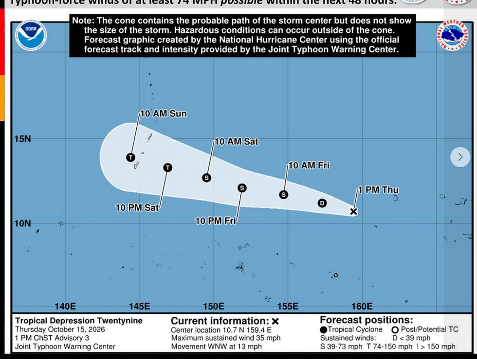
Sinlaku first developed as a tropical storm over Chuuk in the Federated States of Micronesia and has been slowly moving toward the Marianas.
Sinlaku’s northward track has now shifted the typhoon’s path of destruction: At first it was projected to hit Guam, then the Rota Channel, then Rota, just north of Rota, then Tinian and Saipan.
“We'd seen little northward nudges every six-hour track update,” Aydlett said. “And so I think this is where we're starting to see some stability in the track. That it's going to be settling more likely near Tinian and Saipan for the closest point of approach.”
He said the threat to Rota has decreased slightly. Earlier forecasts predicted Category 3 or 4 conditions for Rota, but those conditions have now subsided.
ADVERTISEMENT

“As long as the track does not deviate southward, Rota stands to get by with low and Category 1 (74-95 mph) conditions,” Aydlett said.
Aydlett cautioned that the impacts of a typhoon extend well beyond the center of a tropical cyclone.
He said wind speeds within the cone showing the track of the typhoon could range from as low as 73 miles per hour to peak intensity at the center, where the absolute worst of the conditions are found.
“We're still anticipating seeing this typhoon track toward Tinian and Saipan, but this large enveloping tropical storm force windfield and very heavy showers will continue across all of the Marianas starting later today,” he added.
He warned that flash floods are anticipated to occur in the next 48 hours.
CNMI residents living in non-concrete or flimsy structures are being advised to relocate to more durable shelters.
“If you reside in a structure that may not withstand strong winds, please take proactive steps to seek safer shelter,” Apatang said in an advisory today.
Residents are also advised not to travel unless absolutely necessary. Apatang warned that strong winds and reduced visibility can develop rapidly and pose serious dangers to motorists.
Residents are also being warned to stay away from shorelines and coastal waters. Rough surf and dangerous conditions are anticipated.
Super Typhoon Sinlaku continued its rapid intensification overnight, reaching an incredible 180 mph maximum sustained winds early this morning, according to the National Weather Service.
As of 11 a.m., Super Typhoon Sinlaku was located near 12.2N 148.9E, around 255 miles north of Ulul in Chuuk State, 290 miles east-southeast of
Guam and 295 miles southeast of Saipan.

Subscribe to
our digital
monthly issue