Shelter in place: NWS warns hazardous winds, heavy rains, flash floods can be life-threatening


By Pacific Island Times News Staff
The National Weather Service today raised its advisory from typhoon alert to typhoon warning, advising Guam and Northern Mariana Islands residents to shelter in place by sunset on Sunday.
Guam and the CNMI entered Condition of Readiness tonight.
Weather forecasters have detected showers and thunderstorms building across coastal waters east of Guam as outer rainbands begin to wrap into the region.
Saipan has received just under half an inch of rain. “This is just the beginning,” said Landon Aydlett, a meteorologist at NWS.
“It's only going to gradually worsen as we go through the next 24 hours, rapidly deteriorating as we go through Sunday afternoon, Sunday evening, and then into Monday," he said.
"We're urging people to be in safe shelter from sunset Sunday through sunrise Tuesday. Again, that key time frame to be in safe shelter is sunset Sunday through sunrise Monday," he added.
The Category 5 supertyphoon continues on a forward track that will bring it dangerously close to Guam, Rota, Tinian and Saipan. It will bring heavy torrential rains that will cause flash flooding. “That will be life-threatening,” Brandon Aylett said.
Read related stories
Showers are starting to wrap in across the region from the northeast. These showers will be building overnight, Landon Aydlett said,
ADVERTISEMENT

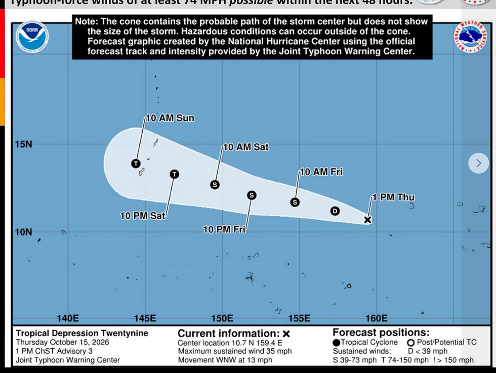
The storm is forecast to pack sustained winds peaking at 175 miles per hour on Sunday and is expected to make its closest point of approach to Guam during the overnight and early morning hours of Monday.
The weather map shows the well-formed eye around 20 nautical miles wide.
“That would encompass all of the island of Rota or all of the islands of Tinian if it were to pass directly overhead," Landon Aydlett said.
At 1 p.m., Bavi was located about 410 miles east southeast of Saipan, 435 miles east of Guam, moving west southwest at eight miles per hour.
"It's been dropping latitude over the last six to eight hours as it was moving just south of due west," Landon Aydlett said. "That means the forecast track overall took a little bit of a southward shift as it is expected to pass through the Mariana Islands on Monday.

Subscribe to
our digital
monthly issue