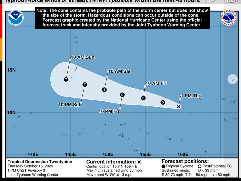
Regional weather outlook: Tropical disturbance Invest 92W tracking between Chuuk and Pohnpei


Key points
  Tropical Disturbance Invest 92W: Between Chuuk and Pohnpei - Likely tracking WNW
  Tropical Disturbance Invest 94W: Well north of Palau, Likely tracking W out of Micronesia
  Monsoon will return to the Marianas around Saturday
Drier pattern prevails across Yap & Palau
Unsettled pattern prevails across Chuuk, Pohnpei, Kosrae and Majuro
(NWS/ Prepared by Paul Stanko, acting SOO) An active pattern prevails across the Marianas and Eastern Micronesia as the monsoon trough remains in place near 20N west of 140E then curves down to near 5N at 180.
Drier weather is found across Palau and Yap State, eastward to Woleai. For Guam and the CNMI: Expect mainly light to gentle winds the next few days with
winds turning southwest and increasing over the weekend as the monsoon trough stays near the islands.
A mix of sun and showers will prevail, along with isolated thunderstorms. Across Palau and Yap State: Weather conditions will remain fairly dry through
the next day or two, then showers will begin to increase for the second half of the week with mainly moderate westerly winds in place.
An unsettled weather pattern will remain in place across Chuuk, Pohnpei, Kosrae and Majuro as Invest 92W and the accompanying monsoon trough shift slowly west-northwestward.
Expect a mix of showers and isolated thunderstorms across the region, with drier conditions north of the monsoon trough. Winds will be predominantly from the west, but may shift locally to the southwest or northwest, with stronger gusts. Showers could be locally heavy at times with briefly strong wind gusts, particularly near and south to southwest of 92W.